UAV RPAS and ROV Survey Inspection and Imaging

SCOPiQS holds a world-class fleet of professional, enterprise, and industrial drones.
We use a range of light and heavy work class Unmanned Aerial Vehicles (UAV), otherwise known as Remotely Piloted Aircraft Systems (RPAS) for aerial assessments. Remotely Operated Vehicles (ROV) are used to inspect underwater assets.

Learn More

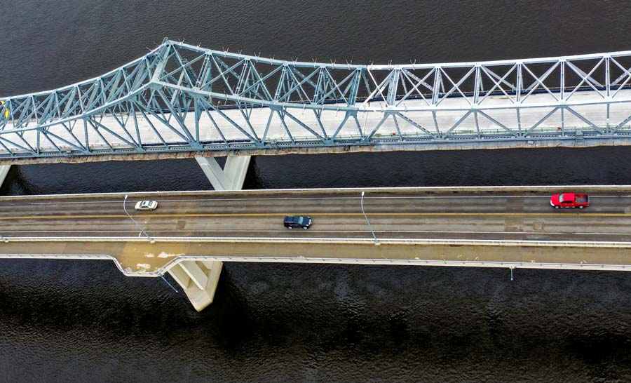
Using an aerial drone to survey assets or access confined spaces, or a submersible underwater ROV for asset inspection in subsurface environments, is one of the most cost effective methods to quickly and safely conduct a visual inspection of overall conditions.

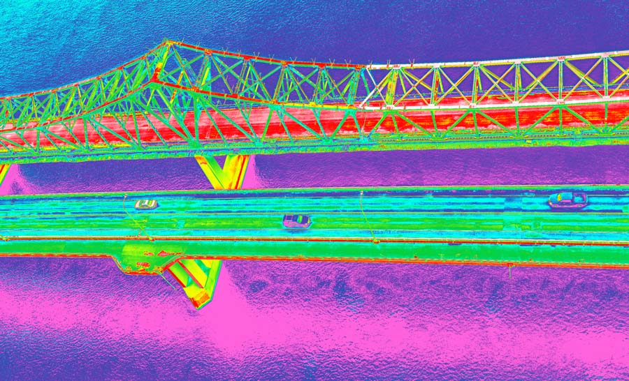
A drone with a thermal camera can capture high definition images and video day or night. This can be used for powerline inspection, applications in agriculture, oil and gas, solar panel inspection, search and rescue, and wildlife detection.

Unmanned Aerial Systems (UAS) and underwater ROV  inspections are also used as part of the non-destructive testing process on assets above or below the ocean, or assets operating under extreme conditions.

UAS and ROV inspections are many times faster than traditional inspections which require human technicians to undergo time consuming and hazardous activities. Using a drone for remote visual inspection can replace manned inspections which may involve trekking deep into inhospitable wilderness, climbing up wind turbines on an offshore wind farm, or taking on the risks of a deepwater diver to conduct underwater inspection. 

Drone inspection increases speed and greatly reduces risk to human life. This in turn means lower operational costs. As a result, UAV and ROV unmanned systems allow you to conduct more frequent, regular inspections. This in turn enables faster recognition of potential areas of concern, and greatly improved, more cost-effective long-term maintenance of assets and structures.

Contact us

Our specific services involving UAV and ROV includes:

Aerial Photography and Videography including timelapse and hyperlapse

Inspection of critical assets using High-Resolution Photography and videography, and photographs, and 3D reality models

3D mapping and photogrammetry

Precision Aerial Mapping and Surveying

Aerial Farm Mapping, often requested to survey crop health, weed and pest ID, crop counting, and irrigation planning,

Night operations including thermal imaging camera

Operations near active aerodromes and in controlled airspace

Thermal Imagery

Construction Projects and Progress Summaries

Among the SCOPiQs fleet of drones are the Matrice 300 and the Matrice 210 which feature an upward facing camera. This enables additional inspection capabilities. The Matrice 300 and Matrice 210 are especially useful for awkward areas such as confined spaces, under bridges or vertical infrastructure.

Why Use SCOPIQS Drone Service

Highly Experienced

Experienced operators with extensive UAV and Fixed Wing Experience

Meticulous Attention to Detail

Each project is assessed to determine the most effective aerial system for your specific needs. Your requirements are met in the most efficient, cost effective, and safest way possible.

Competitive

Have a budget? Talk to us about your cost allocation for your project and we’ll come up with a plan that works within your scope.

15+

Knowledgeable

With over 15 years in the inspection industry, you’re in safe hands.

Proactive

If we think there are ways to do things better or more affordably, we’ll make sure you hear about it.

Quality inspection solutions from Planning to Completion

The SCOPiQS UAV team holds the following current qualifications, certifications, or licenses in UAV operations:

  • Civil Aviation Safety Authority certified (CASA certified) RePL, ReOC, AROC
  • SCOPiQs drones are all fully insured

Looking for drone photography and videography? We do that too.

Is the specific drone service you need not mentioned here? Contact us to discuss your needs.

Get a quote
menu